Stormwater Program
If you’ve walked along Lake Tahoe’s beaches, you have probably spotted them: stormdrains discharging dirty water to Lake Tahoe from surrounding land areas. While stormdrains have the very practical and necessary function of draining water away from urban lands to prevent flooding, they often have the unintended effect of conveying pollution, such as sediment, nutrients, and trash. Left untreated, this pollution impacts Lake Tahoe.
Why is the Stormwater Program important?

Tahoe RCD manages the Regional Stormwater Monitoring Program (RSWMP). RSWMP monitors urban stormwater runoff entering the lake for nutrients and sediments. Most pollutants come from urban areas, especially roads. There are seven jurisdictions around the lake that must comply with regulations established to reduce pollutant loading to the lake.
The goal of RSWMP is to ensure that the seven jurisdictions are meeting regulatory requirements. Data collected by RSWMP can be used to assesses the cumulative effect of environmental improvement projects and better management practices on stormwater quality. Monitoring stormwater runoff at specific sites over the long-term evaluates whether everything the jurisdictions have done to decrease pollutants to the lake is having the desired effect.
Tahoe RCD conducts special research projects on urban stormwater to advance the scientific understanding of factors affecting stormwater quality and how it can be better managed and treated before entering Lake Tahoe.
The Regional Stormwater Monitoring Program (RSWMP), developed in 2015, is a collaboration between the Tahoe RCD and the seven jurisdictions required to comply with the Total Maximum Daily Load (TMDL). The TMDL is a plan to restore lake clarity to 1969 levels, which is about 100 feet of clarity. TMDL regulations require California and Nevada jurisdictions (City of South Lake Tahoe, El Dorado County, Placer County, the California Department of Transportation, Douglas County, Washoe County, and the Nevada Department of Transportation) to take measures to decrease pollutant loading to Lake Tahoe from urbanized areas by implementing pollutant controls to decrease fine sediment particle (particles less than 16 microns) and nutrient (nitrogen and phosphorus) in stormwater. These measures include infiltration basins and swales, filters, better erosion control, and improved traction abrasive application and recovery, among others. The TMDL requires that select urban catchments and Best Management Practices (BMPs) are monitored to ensure that these pollutant reduction strategies are having the desired effect.
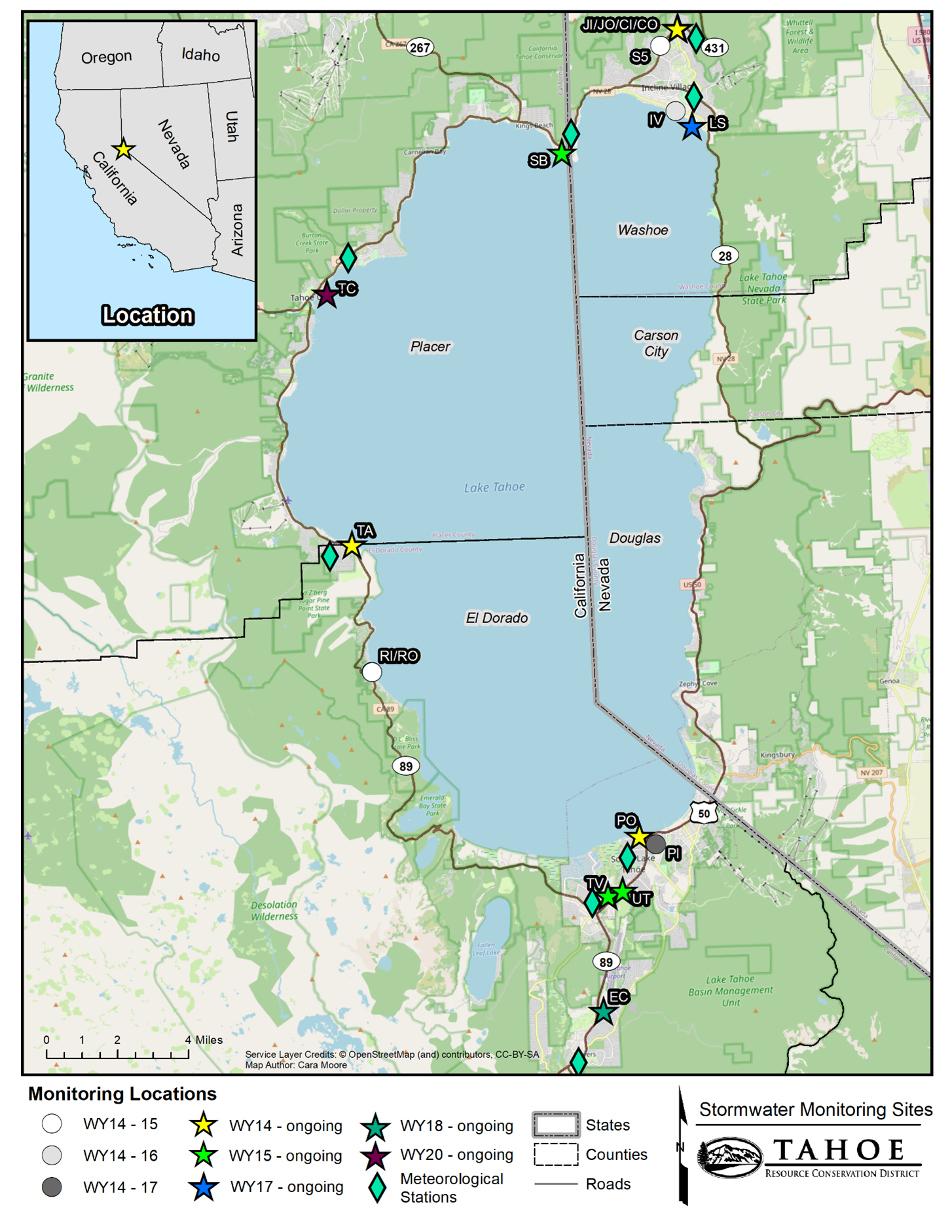
Currently, nine urban catchments are monitored for nutrients and sediments, seven for long-term status and trends at catchment outfalls, and two for BMPs. BMPs currently monitored are pavement condition improvement at Elks Club and stormwater filtration at SR431 (see Special Stormwater Studies for more information). Monitoring at some sites began in 2014, with more added in 2015, 2017, 2018, and 2020. Meteorological stations are located within two miles of its paired monitoring site. Long-term catchment outfall sites were selected based on their proximity to Lake Tahoe, diverse land-use, suitable monitoring location, and a reasonably equitable distribution between participating jurisdictions. BMP sites were selected because of their potential efficacy in treating storm water runoff characteristic of the Lake Tahoe Basin, the broad interest in data regarding the efficiency of the selected BMPs in reducing runoff volumes and pollutant loads (especially fine sediment particles), and the importance of determining maintenance intervals required to retain effectiveness.
For Annual Reports with more information and monitoring findings, please click on the publications and helpful links.
This study is an analysis of projected climate change impacts on the ability of stormwater Best Management Practices (BMPs) to continue to reduce pollutant loads.
This study assists with a project to assess microplastics in stormwater runoff conducted by the Desert Research Institute.
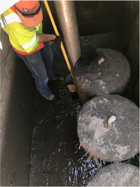
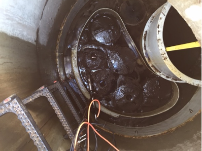
In 2013, the Nevada Department of Transportation (NDOT) installed two side-by-side stormwater treatment vaults on State Route 431 (SR431) in Washoe County above Incline Village, Nevada.
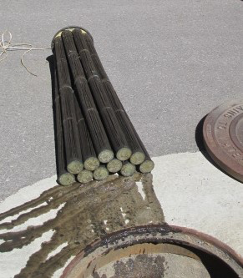
The purpose of the project was to evaluate and compare the effectiveness of two adjacent stormwater treatment vaults, the Contech Media Filtration System (MFS) and the Contech Jellyfish, each containing a different type of filter. Both filter types are designed to remove fine sediment particles, the particles that are primarily responsible for the loss of lake clarity.
NDOT wanted to investigate which filter type worked best for the type of stormwater runoff generally associated with a relatively steep highway with moderate to high traffic density and near 100% impervious surface. Stormwater from this type of roadway tends to have high sediment loads, primarily due to the road sanding necessary to keep vehicles from sliding on ice and snow in the winter.
Stormwater runoff from approximately 1.4 acres of traffic lanes enters a transverse drain adjacent to SR431. It then flows through a pipe to a splitter vault that theoretically routes equal amounts of flow through two inflow pipes to each type of filtration vault. After the runoff has been treated in each filter vault, the flow exits through respective pipes that lead to a perennial stream called Deer Creek. Deer Creek is a tributary to Incline Creek, which discharges to Lake Tahoe.
The inflows and outflows of both vaults have been monitored for the last seven years. We have learned that though sediment removal efficiencies are similar when both vaults are clean, the Jellyfish gets overwhelmed by accumulated sediment more easily and needs to be maintained more often. The Jellyfish vault is much smaller than the Contech MFS vault and can therefore not accommodate as much accumulation before clogging. However, the Jellyfish filters can be cleaned and reused, while the MFS filters must be replaced. Therefore, in a location with lower sediment loads, where the Jellyfish wouldn’t be overwhelmed as often, it may be the cheaper option.
To view the NDOT SR431 seasonal reports visit Publications & Helpful Links
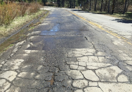
The Elks Club monitoring site is located on the northwest corner of Elks Club Drive and Bel Aire Circle in El Dorado County. It is monitored as a catchment outfall and a BMP at one monitoring station (EC). At 14.4 acres, it is a relatively small catchment comprised primarily of single family residential and secondary road land uses. Elks Club Drive is a fairly steep road that serves as the primary access road for this neighborhood. Runoff is channelized along the north side of the road and routed directly to the monitoring location adjacent to the roadside.
Prior to the summer of 2018, Elks Club Drive was in poor condition, covered in cracks and potholes. Visual observations and a pilot study on Pioneer Trail in El Dorado County from 2012-2014 suggested that the degraded road surface itself was contributing a substantial amount of fine sediment to stormwater runoff.
The Elks Club monitoring site was established to determine if improving road condition would result in decreased FSP loads in stormwater runoff from this catchment. In the summer of 2018, El Dorado County completed an erosion control project in this catchment that included completely reconstructing Elks Club Drive and armoring the road shoulders and roadside channels with asphalt and rocks.
A repaved road is more durable and less likely to deteriorate under the heavy equipment and plow blades used for snow removal operations. The smooth surface is easier to sweep and therefore more road abrasives can be recovered. New roads also look nicer and provide a better driving experience. The primary purpose of this monitoring site is to conduct pre and post project monitoring and perform source apportionment analyses on runoff samples to determine what portion of the fine sediment originates from native soil (road shoulder erosion), traction abrasives (road sand), and asphalt plus asphalt binder (the road itself).
Post project data collected at Elks Club indicates that repaving a road contributes to improved water quality (less sediment). Improved pavement condition should be recognized as a water quality BMP, not only to garner credits for the Lake Tahoe TMDL Clarity Crediting Program but also to potentially open up water quality improvement funds for road maintenance and vice versa. New roads would be beneficial for public safety, vehicle maintenance costs, aesthetic appeal, driving pleasure, road maintenance and sweeping operations, long term durability, snow removal operations, stormwater quality, and lake clarity.
To view the Elks Club Pavement Improvement Study visit Publications & Links


Coming soon..
Partners